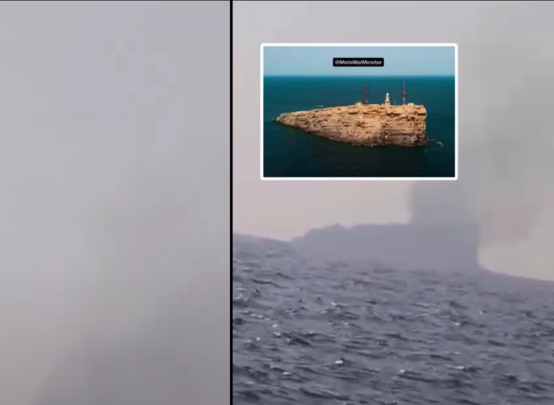
Iran reportedly targeted a radar and communications facility on Oman’s Didamar Island. The IRGC claims the site was used to help ships pass through a US-backed route in the Strait of Hormuz.
Iran has reportedly struck a radar and communications site on Didamar Island, Oman.
The island is located near the Strait of Hormuz. It hosts radar and radio communication infrastructure.
Footage circulating online shows smoke rising from the reported target.
RT reported the incident on November 10. An Iranian Revolutionary Guard Corps (IRGC) official claimed that the targeted systems helped ships pass through the strait.
Iran Claims US-Used Systems Were Targeted
According to the IRGC official, the facility was used to support the movement of ships through a Pentagon-backed maritime route.
The official claimed that Iranian forces destroyed the radar and communications systems.
He also said that no ships passed through the southern route during the previous night.
However, the alleged US military use of the facility has not been independently established.
Satellite Images Show Signs of Damage
Open-source analysts have also examined satellite imagery of Didamar Island.
Sentinel-2 images dated November 8 reportedly show a burn mark near the island’s radar and communications infrastructure.
The reported location is approximately 26°28’38″N, 56°32’19″E.
This observation supports reports of damage at the site. However, satellite imagery alone cannot confirm who carried out the attack.
Why Didamar Island Matters
Didamar Island is located near an important maritime corridor.
The Strait of Hormuz connects the Persian Gulf with the Gulf of Oman and the Arabian Sea.
It is a major route for international oil and gas shipments.
Radar and communication systems help monitor maritime traffic. They also support coordination between vessels and coastal authorities.
Damage to these systems could affect shipping operations in the surrounding waters.
What We Know So Far
- Location: Didamar Island, Oman.
- Reported target: Radar and radio communications infrastructure.
- Attacker: Iran, according to reports and Iranian claims.
- Iranian position: The IRGC says the systems helped ships use a Pentagon-backed route.
- Satellite evidence: Sentinel-2 imagery reportedly shows a burn mark near the infrastructure.
- Unconfirmed detail: The alleged US Navy use of the facility has not been independently established.
The reported strike adds another development to the growing tensions around the Strait of Hormuz.
THE WORLD’S UPDATE will continue following developments affecting Iran, Oman and international shipping through the Strait of Hormuz.
Sources
- RT – Original report and footage: https://x.com/RT_com/status/2119843849363407206
- Open-source satellite imagery assessment: https://sh1n.org/tweets/a-burn-mark-can-be-seen-on-the-tip-of-the-omani-island-of-didamar-on-sentinel-2-satellite-2119872731827122235
Standing with the oppressed. Speaking for the unheard. Seeking truth without fear.